
Hurricane Matthew Leaves Behind a Trail of Devastation
October 19, 2016
Hurricane Matthew started as a tropical storm right above the the northwest coast of South America. On September 29th, it reached hurricane status as a Category 1 storm. (75 mph sustained winds). However, in less than 24 hours, Matthew rose to an intimidating category 5 storm as it moved slowly in tropical waters. Matthew’s winds reached a sustained peak of 160 mph with gusts whipping over 200 mph. Luckily for humanity, the storm was still over water at its strongest point.
Matthew made its first landfall in Haiti as a Category 4 storm. Though downgraded, this storm still had sustained winds of 145 mph. Not only were the winds responsible for the 264 deaths, but rainfall reached around 7 inches and a storm surge that was increasingly high. Matthew neared Cuba as a Category 3 hurricane. Unnecessary personnel were evacuated from Guantanamo Bay, but little damage was recorded.
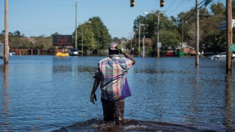
From here the storm made it’s way up the coast of North America. Now in open, warm water again, it began to regain its strength. Here, Matthew also developed massive amounts of rain and obtained a peaking storm surge of 9.88 feet. (In comparison, the storm surge in New Jersey from Hurricane Sandy was 9.44 feet). There were 6 United States deaths due to the overwhelming nature of the storm. Still, much of Georgia and the Carolinas are still flooded from the storm. Matthew made its last landfall in South Carolina as a Category 1 storm. It caused a record in tidal levels (12.75 feet above average) and almost 14 inches of rain poured down within six hours. 487,000 acres of Georgia and the Carolinas were found without power and much of these people are still trying to recover today.